There's a version of site grading that looks great on paper. The finished grade matches the civil drawings, the slopes hit their target percentages, and the crew wraps up on schedule. Then it rains — and the parking lot ponds, the foundation drains back toward the building, and the GC is on the phone asking why the site wasn't graded correctly.
The answer, almost every time, is that the grading plan started with grade and worked backward to drainage — instead of starting with drainage and letting the grade follow. That single inversion of priorities is responsible for more rework, more erosion callbacks, and more blown material budgets than almost any other mistake in earthwork contracting.
This article is about flipping that sequence. It's about understanding drainage not as something civil engineers clean up after grading is done, but as the core logic that should organize every cut, fill, and spoils decision from day one.
The Fundamental Mistake: Grading First, Drainage Later
The conventional workflow on many earthwork projects goes something like this: the civil engineer produces a grading plan with finished elevations, the earthwork contractor mobilizes and starts moving dirt to hit those elevations, and drainage features — swales, inlets, detention basins — get treated as add-ons to be handled near the end of the job.
This sequence feels logical because the grading plan exists and is fundable. But it has a structural flaw: it treats the site as a static geometry problem rather than a dynamic water management problem.
Water does not care about your finished elevation contours. It follows gravity, moves to low points, and will find any path of least resistance you've inadvertently created. When drainage isn't designed into the grading logic from the beginning, the finished grade often creates new water concentration points that weren't on the original topo — and those points become problems the moment it rains.
The downstream consequences are well documented in the industry:
- Foundation damage from improper positive drainage away from structures. The standard of at least 5% slope for the first 10 feet away from a foundation exists precisely because water pooling against a slab or footing is a structural liability.
- Pavement failure from subgrade saturation. Flexible pavements lose load-bearing capacity rapidly when the subgrade moisture content rises above optimum — a direct result of poor surface drainage.
- Erosion and sediment loss from concentrated runoff channeling across unprotected slopes. This isn't just a site performance issue; it's a regulatory one. The EPA's stormwater discharge requirements for construction activities mandate Stormwater Pollution Prevention Plans (SWPPPs) on sites one acre and larger, and improper grading that creates erosion is a primary source of NPDES permit violations.
- Material rework costs that can run 15–30% over original earthwork budgets when cut and fill volumes are recalculated mid-job to accommodate drainage features that weren't accounted for upfront.
The fix isn't complicated in principle. It just requires a different starting question: not "where does the grade need to be?" but "where does the water need to go?"
Reading a Site's Drainage Profile Before You Grade
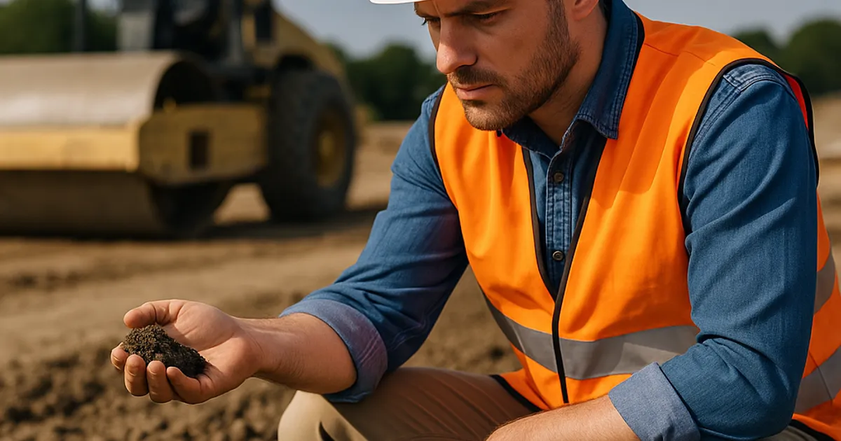
Every site tells you where water wants to go before you touch it. The job of a skilled grading contractor is to read that story accurately — and then decide how much of it to work with versus work against.
Topographic Analysis
The topo sheet is your first tool, but it's not enough on its own. Contour lines show elevation changes, but they don't show soil infiltration rates, existing subsurface drainage, or the location of off-site drainage features that affect your site. Start with the topo and then layer in additional data.
Key things to identify on the topo before bidding or planning:
- Natural low points and swales: Where do contours form a "V" pointing uphill? That's a natural drainage concentration point.
- Ridge lines and high points: These are your drainage divides — water on either side will flow in opposite directions.
- Existing outfall locations: Where does water currently leave the site? Is that outfall adequate for post-development flows, or will your grading concentrate more runoff into an undersized outlet?
- Adjacent property grades: Grading that redirects runoff onto neighboring properties is a legal liability and a common source of disputes on tight urban lots.
Soil Survey Data
The USDA Web Soil Survey provides free, location-specific soil data that can dramatically change your drainage assessment. Soils with high clay content and low permeability (Hydrologic Soil Group C and D soils) will produce significantly more surface runoff than sandy loam soils, meaning swales and detention features need to be sized accordingly. Knowing this before you bid means you're not discovering it during construction.
Field Walking the Site
No amount of desktop analysis replaces time on the ground. Walk the site after a rain event if possible. Look for:
- Areas of standing water or water-stained soil
- Existing ruts or erosion channels that indicate natural flow paths
- Vegetation patterns — wet-tolerant species like cattails or willows often indicate seasonal high water
- Soil color changes at depth that suggest seasonal saturation (gleying — grayish, mottled soils)
Tools like Low Point Labs provide a drainage intelligence layer specifically built for this pre-grading analysis phase, giving contractors and site professionals the ability to identify low points, flow paths, and concentration zones before work begins — so grading decisions are made with the full hydrological picture, not just what's visible on the topo sheet.
Low Points: The Make-or-Break Feature of Every Grading Plan
Every site has low points. On a natural, undeveloped site, those low points are functional — they collect water and move it toward streams, wetlands, or infiltration areas through processes that have evolved over time. When you grade a site, you're taking over that function. The question is whether you're doing it intentionally or accidentally.
Natural Low Points vs. Grading-Created Low Points
Natural low points are predictable. They're on the topo, they often have existing drainage infrastructure nearby (culverts, ditches), and they've been handling runoff long enough that you can observe how they perform.
Grading-created low points are the dangerous ones. These appear when:
- Fill is placed to raise an area but doesn't quite connect to an existing outlet, creating a trapped depression
- Cut slopes are created that concentrate runoff at their toe without a planned conveyance away from that point
- Finished grades are set based on design elevations without checking that every area has a positive drainage path to an outlet
A grading-created low point with no outlet is essentially a bathtub. It will fill with water until it finds a path — and that path is usually through someone's foundation wall, across a neighboring lot, or down a slope you just finished.
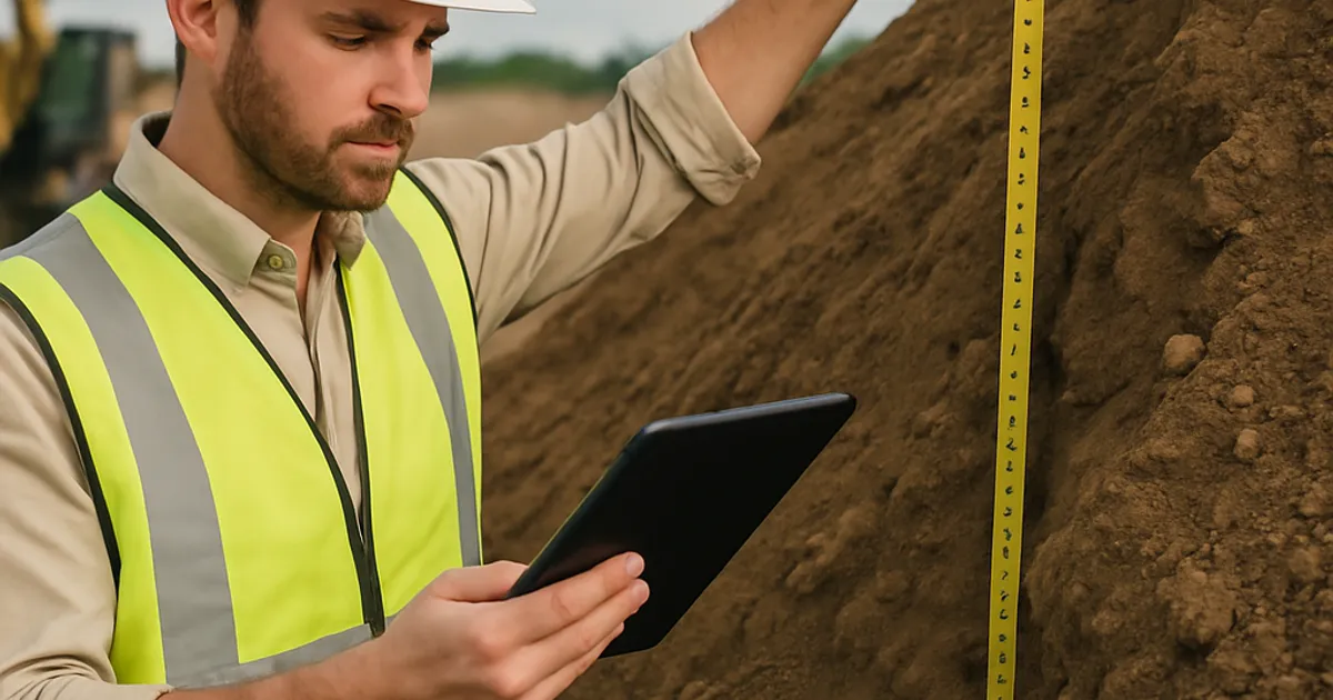
The Drainage Area Calculation You Should Do Before Bidding
For every site you're grading, do a rough drainage area calculation before you finalize your bid:
- Delineate the drainage area — What area of land drains to each low point or outlet on the site?
- Estimate runoff coefficient — Based on soil type and proposed land use, how much of the rainfall becomes runoff? A parking lot might generate runoff coefficients of 0.85–0.95; lawn areas might be 0.20–0.35.
- Size the outlet — Can the existing outlet handle the post-development runoff from that drainage area, or does your grading plan need to include detention or retention to manage peak flows?
This doesn't need to be an engineered stormwater analysis — that's the civil engineer's job. But having enough hydrological literacy to flag potential outlet capacity problems before they become your problem on site is a real competitive differentiator.
How Drainage-First Thinking Changes Your Cut/Fill Balance
Here's where drainage planning hits your bottom line most directly: the cut/fill balance.
When earthwork contractors develop their cut/fill calculations, the standard approach is to calculate volumes based on existing grades and design finished grades, then determine what moves off-site (excess cut) and what needs to come in (import fill). But this calculation is incomplete until drainage features are designed in.
Swales, detention basins, bioretention areas, and berms all move significant volumes of material. A detention basin that's 200 feet long, 50 feet wide, and 4 feet deep displaces roughly 2,200 cubic yards of material. If that basin wasn't in the original cut/fill calculation, your material balance is off by 2,200 cubic yards — and that number has real dollar consequences.
What Shifts When You Account for Drainage Features
| Drainage Feature | Volume Impact | Common Surprise | |---|---|---|| | Detention/retention basin | Large cut volume — often 500–5,000+ CY | Material assumed to stay on site must actually be exported | | Swales and bioswales | Moderate cut along flow path | Changes the grade of areas that seemed balanced | | Berms and check dams | Requires fill material | Import needs increase if site soil isn't suitable | | French drain trenches | Minor cut, but requires aggregate | Aggregate import often not included in original budget | | Infiltration basins | Cut volume similar to detention | May require engineered fill media — not native soil |
The practical implication: if you're doing cut/fill calculations before the drainage features are designed into the plan, you're working with incomplete information. And if you're bidding on that incomplete information, you're exposed.
When drainage features are properly accounted for and the material balance shifts — either creating excess material that needs to move or revealing a shortage that requires import — platforms like DirtMatch connect contractors with nearby sources and destinations for dirt and aggregate, making it possible to resolve material balance problems quickly without resorting to expensive commercial hauling or tipping fees at distant landfills.
Swales, Berms, and Detention: Designing Drainage Into the Grade
Drainage-first grading doesn't mean you're doing the civil engineer's job. It means you understand the drainage features well enough to integrate them into your earthwork plan rather than treating them as afterthoughts.
Swales
A swale is a shallow, vegetated channel designed to convey and filter stormwater runoff. In grading terms, it's a linear depression with controlled side slopes that directs water from one point to another.
Swale design basics every grading contractor should know:
- Minimum slope: 1% to maintain flow and prevent standing water; 0.5% is sometimes used in flat terrain with careful design
- Maximum slope: Typically 4–5% for vegetated swales before erosion control measures are required; steeper slopes need armoring with riprap or concrete
- Side slopes: Typically 3:1 (horizontal:vertical) or flatter for safety and mowability
- Bottom width: Varies, but 2–4 feet is common for residential applications; wider for larger drainage areas
When you're grading a swale, you're creating a precise linear landform with specific slope and cross-section requirements. That's earthwork — and accounting for it properly in your cut/fill math means knowing where that material comes from and where it goes.
Berms
Berms are linear raised landforms used to redirect runoff, protect areas from off-site drainage, or create visual screening. From an earthwork standpoint, they require fill material that has to come from somewhere — either cut material from elsewhere on the site or imported fill.
Key grading considerations for berms:
- Material quality matters: berms that will be vegetated need topsoil on the outer layer, which may need to be stockpiled separately during grading operations
- Compaction requirements vary: a decorative berm has different compaction specs than a berm designed to retain water
- Height and slope affect material volume significantly — a small change in design height creates a large change in fill volume
Detention and Retention Basins
Of all the drainage features in a grading plan, detention and retention basins have the largest volumetric impact on your earthwork. These are engineered structures designed to capture stormwater runoff and release it slowly, reducing peak flow rates and protecting downstream areas from flooding.
The difference: detention basins hold water temporarily and drain completely between storm events; retention basins (wet ponds) maintain a permanent pool of water.
From a grading standpoint:
- Basin excavation is typically your largest single source of cut material on a site with detention requirements
- The material removed from basin excavation needs somewhere to go — and it may or may not be suitable for use as structural fill elsewhere on the site
- Clay-heavy soils excavated from a basin may be excellent for building berms but poorly suited for use as subgrade fill under pavement
This material sorting requirement is where having a network of nearby contractors who need or have specific material types becomes a real operational advantage. DirtMatch gives grading contractors the ability to list excess cut material — including basin spoils — and connect with nearby projects that need fill, turning what would otherwise be a disposal cost into a recoverable value.
Regulatory Compliance: Drainage Planning Isn't Optional
For any project site over one acre, drainage planning during grading isn't just good practice — it's a federal regulatory requirement.
The EPA's National Pollutant Discharge Elimination System (NPDES) program requires construction site operators to obtain permit coverage under a Construction General Permit (CGP) and implement a Stormwater Pollution Prevention Plan (SWPPP). The SWPPP must include best management practices (BMPs) to control erosion and sedimentation — which directly implicates how the site is graded and where drainage features are located.
Grading decisions that concentrate runoff without providing sediment control at the outlet point create measurable permit violations. Inspectors look specifically for:
- Bare soil areas with concentrated flow paths and no sediment trapping
- Grading that directs runoff off-site without energy dissipation
- Disturbed areas that have been graded but not stabilized within permit-required timeframes (typically 14 days of inactivity)
Beyond federal requirements, most states and many municipalities have local stormwater ordinances that are more stringent than federal minimums. Many jurisdictions now require post-development peak flow rates to match or not exceed pre-development rates for the 2-year and 10-year storm events — which means drainage features need to be sized for those storms, and grading needs to be designed to direct flow to those features.
The Army Corps of Engineers also has jurisdiction over any grading that affects jurisdictional wetlands or waters of the U.S. under Section 404 of the Clean Water Act. Grading that fills or redirects drainage in or near wetland areas may require a permit from the USACE Regulatory Program before work begins.
Find or Post Dirt, Rock & Aggregate
Join thousands of contractors using DirtMatch to buy, sell, and exchange earthwork materials.
Try DirtMatch FreeThe Erosion Problem You Create When You Get Drainage Wrong
Erosion is fundamentally a drainage problem. Water moving across exposed soil picks up and carries sediment. The faster and more concentrated the flow, the more erosion occurs. When grading creates concentrated flow paths that weren't anticipated in the erosion control plan, the result is gullying, slope failure, and sediment deposition in areas where it doesn't belong.
The cost of erosion-related rework is substantial. Slope repairs after erosion damage typically run $15–$40 per square yard depending on the severity and the repair method. Sediment removal from detention basins that silted up during construction can add $10,000–$50,000 to a project cost. And if sediment escapes the site and reaches a waterway, the regulatory consequences — including stop-work orders and fines — can dwarf the physical cleanup costs.
Common Grading Mistakes That Create Erosion
Creating concentrated flow without a defined channel: When grading directs water toward a low point without a stabilized swale or channel to convey it, the water creates its own channel through the path of least resistance — and that path is usually across your freshly graded slope.
Leaving abrupt grade breaks unprotected: Where a slope transitions from steep to flat, water velocity changes rapidly, causing turbulence and scour. These grade break points need energy dissipation — riprap aprons, check dams, or stilling basins — or they become erosion hotspots.
Grading outfall areas without protection: The point where water leaves a swale, pipe, or channel and enters a broader area is where erosion is most concentrated. Outfalls need energy dissipation structures sized for the design flow.
Compacting slopes beyond design: Overcompacted slopes have reduced infiltration capacity, increasing surface runoff and erosion potential. Understanding the relationship between compaction, permeability, and runoff is part of grading with drainage awareness.
Equipment Choices and Drainage-Aware Grading Techniques
Drainage-first grading also affects which equipment you bring and how you sequence the work.
Sequencing for Drainage
The fundamental rule: establish drainage before you expose large areas of bare soil. This means:
- Install perimeter controls first — silt fence, sediment basins, and inlet protection before any grading begins
- Grade from high points to low points — work with gravity rather than against it
- Establish swales and outlet structures early — don't leave them until the end of the job
- Protect cut slopes immediately — seeding, erosion blankets, or temporary berms as soon as a slope is created
- Don't grade more area than you can stabilize within permit timeframes
GPS Grade Control and Drainage Precision
Modern GPS machine control systems — from manufacturers like Trimble Construction — allow operators to grade to precise elevations and slopes that match the drainage design, reducing the risk of inadvertently creating flat spots or reverse grades that collect water. On large sites, the difference between a 0.5% slope and a 0.1% slope (which might drain vs. pond) is invisible to the naked eye but perfectly achievable with grade control technology.
GPS machine control also reduces the number of survey stakes needed and the associated rework when stakes are disturbed — a significant efficiency on sites with complex drainage patterns.
Equipment Selection for Drainage Features
Not every piece of equipment is equally suited for creating precise drainage landforms:
- Motor graders: Best for creating and finishing swales with consistent slope — blade control allows precise cross-section shaping
- Excavators: Best for detention basin excavation and for tight areas where dozer operation would over-disturb the area
- Dozers: Efficient for mass grading and rough shaping, but less precise for finished swale work
- Compactors: Critical for berm construction — berms that retain or redirect water need adequate compaction to prevent seepage
Drainage Intelligence as a Competitive Differentiator
Here's the business case that goes beyond doing better work: contractors who can talk intelligently about drainage at the earthwork stage win more work and get better margins.
Developers and GCs have been burned by grading contractors who delivered a finished grade that didn't perform. The remediation costs — additional grading, added drainage structures, pavement removal and replacement — are painful and memorable. When a developer finds a grading contractor who can walk a raw site, identify drainage constraints, and explain how the grading plan will address them, that contractor moves to the top of the short list.
This matters even more in regions with complex drainage environments. In markets like dirt exchange in Denver, where development sites often interact with Front Range drainage systems and local detention requirements are stringent, or in dirt exchange in Seattle, where the combination of clay soils and high rainfall makes drainage planning especially consequential, the ability to demonstrate drainage competence at the bid stage is a genuine market advantage.
The contractors who build this reputation do a few things consistently:
- They review drainage plans in detail before mobilizing and ask questions if something doesn't account for what they observed during site walking
- They document drainage-related decisions during construction — photos, notes, and as-built measurements that protect them if drainage performance issues arise later
- They communicate proactively with GCs and civil engineers when field conditions differ from design assumptions
- They use tools and platforms that help them make better pre-grading decisions — from soil survey data to drainage analysis tools like Low Point Labs
Material Balance, Spoils Management, and the Drainage Connection
When drainage is designed into the grading plan from the start, the cut/fill balance often looks different than it would on a grade-first plan. Sometimes dramatically different.
Here's a practical example: a 5-acre commercial pad site that initially appears to be near cut/fill balance based on finish grade requirements. When drainage is properly designed in — including a 1,500 CY detention basin, 3,000 linear feet of swales, and a series of perimeter berms — the site now has a net cut of 2,200 CY that needs to find a home somewhere.
That 2,200 CY of excess material has real value to a contractor running a fill-short project nearby. Without a way to connect those two projects, the material goes to a commercial tipping facility at $8–$20 per cubic yard — a cost of $17,600–$44,000 that wasn't in the original bid. With a connection in place, that material moves at or near trucking cost, and both contractors benefit.
This is exactly the scenario DirtMatch is built to solve. By connecting contractors who have excess cut with those who need fill — accounting for material type, location, timing, and volume — the platform turns drainage-driven material imbalances from a cost center into a managed logistics problem. For grading contractors who regularly encounter this situation, getting started with DirtMatch before the job begins means having a solution ready when the material balance shifts.
Regional markets where this is especially valuable include dirt exchange in Los Angeles and dirt exchange in San Diego, where tight urban development sites, strict environmental controls, and high tipping fees make on-site material reuse and nearby contractor connections financially significant.
Building a Pre-Grading Drainage Review Into Your Standard Process
The most actionable takeaway from this article is simple: make drainage review a formal step in your pre-mobilization process, not an informal afterthought.
Here's a practical pre-grading drainage checklist that experienced earthwork contractors use:
Pre-Grading Drainage Review Checklist
Site Analysis
- Reviewed topo for natural low points and drainage divides
- Pulled soil survey data for site and surrounding area
- Walked site (ideally after rain event) to observe actual drainage patterns
- Identified existing drainage infrastructure on and adjacent to the site
- Confirmed off-site drainage features that accept or contribute flow to the site
Plan Review
- Verified all drainage features are included in cut/fill calculations
- Confirmed every area of the finished grade has a positive drainage path to an outlet
- Identified any potential grading-created low points with no outlet
- Reviewed outlet structures for capacity relative to contributing drainage area
- Confirmed SWPPP requirements and BMP locations
Material Balance
- Recalculated cut/fill with drainage features included
- Identified surplus or shortage volumes resulting from drainage feature requirements
- Assessed material quality suitability for reuse in drainage-adjacent applications
- Identified sources for import material if needed (aggregate, engineered fill)
- Lined up connections for excess material export if net cut exceeds site use
Regulatory
- Confirmed permit requirements for stormwater management
- Verified no jurisdictional wetlands are affected by grading plan
- Confirmed stabilization timeframes required by permit
The Long Game: Why Drainage Competence Builds a Durable Business
Earthwork contracting is a repeat-business industry. The contractors who grow consistently aren't necessarily the ones with the most equipment or the lowest bids — they're the ones who deliver sites that perform. And a site that performs is, fundamentally, a site that manages water correctly.
Every grading project you complete becomes a reference. If the drainage works, if the lot doesn't pond, if the slopes hold, if the GC doesn't get a call from the developer six months after turnover asking why water is getting into the building — that's a reference that builds your reputation and wins the next job.
If the drainage doesn't work, the inverse is equally true. Drainage failures are visible and memorable. They're the kind of thing GCs and developers talk about when they're evaluating contractors for the next project.
The contractors who understand that earthwork is fundamentally water management — that every cubic yard of dirt they move is a decision about where water goes — are operating at a fundamentally higher level than those who treat drainage as someone else's problem.
Start with the water. Grade accordingly. And when the material balance shifts because you did the drainage math right upfront, have a plan for where that dirt goes. That's the full picture of drainage-aware earthwork — and it's what separates the contractors who win repeat business from those who are always chasing the next bid.
DirtMatch connects earthwork contractors with the material and project connections they need to keep jobs moving. Whether you've got excess cut from a drainage basin or need fill to complete a graded area, how DirtMatch works is built around exactly this kind of material logistics challenge.