The global construction industry generates approximately 3.9 billion tons of excavated soil and sediment every year, according to estimates from the European Environment Agency. A staggering portion of that material ends up in landfills or costly off-haul situations when it could be redirected, reused, or exchanged between nearby job sites. The result? Billions of dollars in unnecessary trucking costs, mounting landfill fees, and carbon emissions that the industry is under increasing pressure to eliminate.
But a technology revolution is underway. Driven by the convergence of artificial intelligence, the Internet of Things (IoT), real-time data analytics, autonomous equipment, and digital marketplace platforms, soil management — long considered one of construction's most unpredictable and labor-intensive challenges — is being fundamentally reimagined.
This guide explores the most significant technological advances reshaping soil and earthwork management, what they mean for contractors, project owners, and the environment, and how platforms like DirtMatch are accelerating the shift toward smarter, more sustainable earthwork operations.
Why Soil Management Has Always Been Construction's Hardest Problem
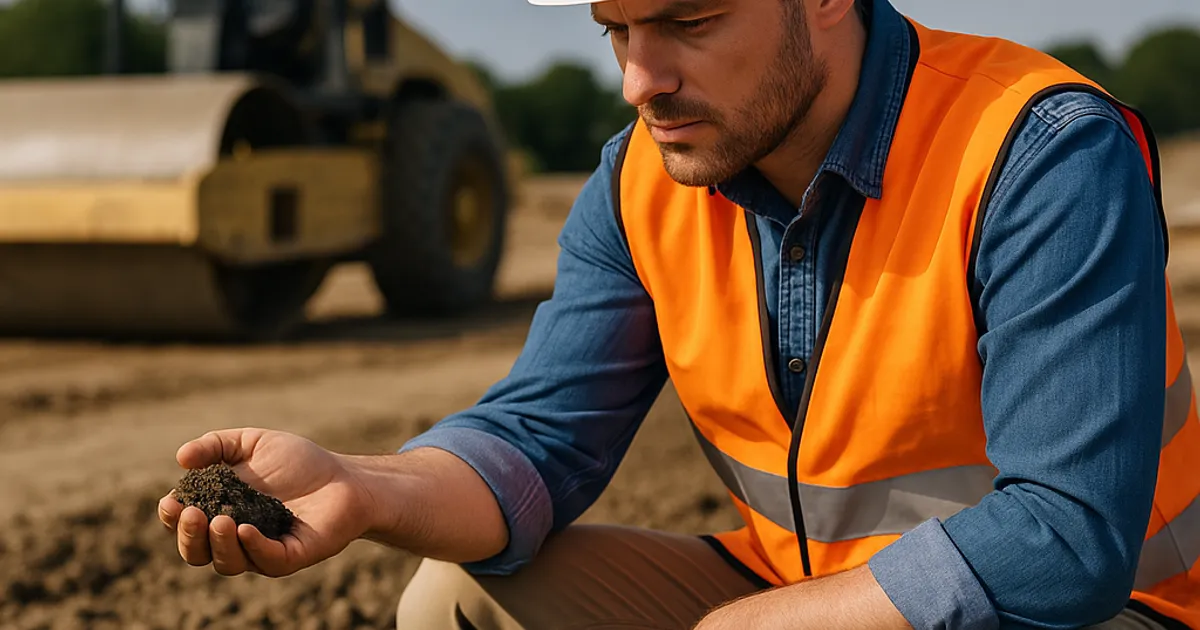
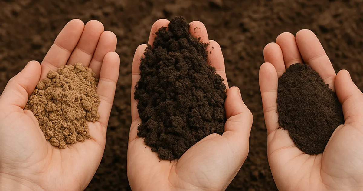
Soil is not a uniform commodity. Its behavior under load, its suitability for compaction, its moisture content, its bearing capacity, and its chemical composition vary dramatically — sometimes within a single project site. This variability has historically made soil management one of the most technically complex and financially risky aspects of any construction project.
According to the Federal Highway Administration (FHWA), poor subgrade soil conditions are among the leading contributors to pavement failures, foundation settlement, and infrastructure underperformance in the United States. Managing soil properly from the outset isn't just good practice — it's an engineering imperative.
The financial stakes are enormous. Industry data consistently shows that earthwork cost overruns account for 25–40% of all construction project overruns, frequently caused by unexpected soil conditions, inefficient material hauling, and poorly calibrated compaction efforts. A single miscalculation in cut-and-fill balance on a highway project can mean tens of millions of dollars in additional trucking and material procurement costs.
Traditionally, soil management has relied on:
- Manual sampling and lab testing that takes days or weeks to return actionable data
- Paper-based cut-and-fill calculations that become outdated as site conditions change
- Experiential judgment from operators and geotechnical engineers rather than real-time instrumentation
- Phone-and-fax networks to find buyers or sellers for surplus excavated material
Each of these approaches introduces latency, error, and cost into the process. The technologies emerging today are designed to eliminate each of these inefficiencies — replacing them with faster, more accurate, and more connected systems.
AI and Machine Learning in Geotechnical Analysis
Artificial intelligence is beginning to transform how geotechnical data is collected, interpreted, and applied on construction sites. Traditionally, a geotechnical investigation involved drilling bore holes, collecting soil samples, shipping them to a laboratory, and waiting days for results. That workflow is being compressed and enhanced by machine learning algorithms that can predict soil behavior from a much wider range of inputs.
Predictive Soil Classification
Researchers at institutions including MIT and Stanford have developed machine learning models capable of classifying soil types and predicting bearing capacity from non-destructive testing data, ground-penetrating radar (GPR) outputs, and remote sensing datasets with accuracy rates exceeding 92% when validated against traditional lab testing. These models are trained on vast geotechnical databases and can be deployed in the field via ruggedized tablets or connected directly to drilling equipment.
For contractors, this means faster site characterization. A project that once required two weeks of geotechnical investigation might be preliminarily characterized in two to three days, allowing earthwork planning to begin earlier and procurement decisions to be made with greater confidence.
AI-Driven Cut-and-Fill Optimization
One of the most impactful applications of AI in earthwork is cut-and-fill optimization — determining how to most efficiently balance the volume of soil cut from high areas of a site with the volume needed to fill low areas, minimizing the amount of material that must be imported or exported.
Software platforms such as Trimble Business Center and Caterpillar's SiteVision already incorporate algorithmic optimization engines that analyze site topography, project design files, soil swell and shrinkage factors, and equipment productivity data to generate optimized earthwork plans. Studies from the Construction Industry Institute (CII) suggest that AI-optimized earthwork planning can reduce total material movement by 15–30% on complex grading projects, translating directly into lower fuel, labor, and equipment costs.
Machine Learning for Contamination Detection
AI is also making inroads in environmental soil management. Neural network models trained on hyperspectral imaging data can now identify soil contamination signatures — including heavy metals, hydrocarbons, and chlorinated solvents — at the surface level, allowing site managers to quarantine contaminated zones before excavation commences. This capability is particularly valuable in urban redevelopment projects where brownfield conditions are common and regulatory compliance under the EPA's Brownfields Program requires thorough contamination assessment.
IoT Sensors and Real-Time Compaction Monitoring
Soil compaction is one of the most critical quality control activities in construction. Improperly compacted fill material causes settlement, pavement cracking, slope failures, and utility damage — problems that are enormously expensive to remediate after the fact. Historically, compaction quality was verified using nuclear density gauges or sand-cone tests at discrete sampling points, a method that captures only a tiny fraction of the total compacted area.
Intelligent Compaction Technology
Intelligent Compaction (IC) technology — now referenced in specifications by many state Departments of Transportation and the FHWA — integrates accelerometers, GPS positioning systems, and real-time data management software directly into compaction rollers. As the roller traverses the fill surface, it continuously measures the stiffness response of the soil beneath it and maps the results against GPS coordinates.
The result is a 100% coverage compaction map of the entire fill area rather than a statistically sampled subset. When areas of insufficient compaction are identified, the operator receives an immediate alert and can make additional passes before moving on. When areas have reached target stiffness values, the operator avoids over-compaction, which can cause aggregate breakdown and reduced bearing capacity in granular materials.
The FHWA's Accelerated Implementation of Intelligent Compaction Technology program reports that IC technology adoption has reduced compaction-related rework costs by up to 50% on participating highway projects. The specifications for IC technology implementation are increasingly referenced in ASTM standards, including ASTM E2583 (Standard Test Method for Measuring Deflections with a Light Weight Deflectometer) and related documents governing soil stiffness measurement.
IoT Moisture Sensors for Proactive Soil Management
Moisture content is the single most important variable in achieving proper soil compaction. Too wet, and the soil will pump and deform under roller pressure. Too dry, and particles won't bond properly under compactive effort. Maintaining moisture content within the ±2% of optimum moisture content specified in most earthwork quality control plans requires constant monitoring across large fill areas.
Wireless IoT soil moisture sensors embedded in active fill areas now transmit real-time moisture readings to site management dashboards. Combined with weather forecast data and evapotranspiration models, these systems can alert crews when moisture conditions are approaching out-of-spec ranges hours before they become problematic, allowing water trucks or drying operations to be deployed proactively.
Digital Platforms and the Dirt Exchange Revolution
Perhaps the most immediately impactful technology transformation in soil management isn't happening inside a laboratory or aboard a piece of equipment — it's happening in the digital marketplace. For decades, the exchange of surplus excavated soil, structural fill, and aggregate materials between construction projects was accomplished through word-of-mouth, broker relationships, and classified advertisements. It was inefficient, geographically limited, and often left contractors paying to truck away material that a nearby project desperately needed.
Digital dirt exchange platforms have fundamentally changed that equation. By aggregating supply and demand for earthwork materials across geographic regions in real time, these platforms allow contractors to:
- Find nearby sources of clean fill rather than purchasing virgin material
- Redirect surplus excavated soil to projects that need it rather than paying landfill tipping fees
- Negotiate and execute material transfers quickly and transparently
- Reduce empty truck miles by coordinating hauls that would otherwise run one-way
For contractors operating in high-activity markets like the Pacific Northwest or California, platforms like DirtMatch connect excavation contractors, general contractors, and site developers across regional networks — making it possible to match a project generating 5,000 cubic yards of clean sandy loam with a fill project two miles away that needs exactly that material. The logistics efficiency gains are substantial: industry practitioners report hauling cost reductions of 30–45% when material sources are identified within a 15-mile radius compared to hauling from commercial fill suppliers located 30+ miles away.
For contractors working in major urban construction markets — where land costs, regulatory scrutiny, and logistical constraints are most acute — local dirt exchange networks are especially valuable. The dirt exchange in San Francisco and dirt exchange in Los Angeles markets demonstrate how densely active construction environments create ideal conditions for platform-based material matching, with dozens of active projects operating simultaneously within tight geographic radii.
Autonomous Equipment and Robotics in Earthwork
The earthmoving equipment sector is undergoing its most dramatic transformation since the replacement of horse-drawn scrapers with diesel-powered machines in the early 20th century. Autonomous and semi-autonomous earthmoving equipment is moving from concept demonstrations to active deployment on commercial construction sites.
Autonomous Dozers and Scrapers
Komatsu's Smart Construction platform, Caterpillar's Command for Grading system, and Built Robotics' autonomous excavator retrofit kits represent the leading edge of autonomous earthwork equipment commercially available today. These systems use a combination of GNSS positioning (achieving centimeter-level accuracy), LiDAR point cloud scanning, and machine learning-based obstacle detection to operate earthmoving equipment with minimal or zero human intervention.
In controlled deployments, autonomous dozer systems have demonstrated productivity improvements of 20–25% per shift compared to manually operated machines, with the added benefit of eliminating operator fatigue-related performance degradation during nighttime or extended shifts. The systems never take breaks, never lose focus, and consistently execute blade control with precision that even experienced operators struggle to match over an 8-hour shift.
From a soil management perspective, autonomous grading systems offer a particularly significant advantage: consistent, grade-compliant earthwork. When a dozer is executing final grading to design grade automatically, over-excavation events — which create the need for imported fill material that could otherwise be avoided — are dramatically reduced.
Robotic Soil Sampling
Beyond earthmoving, robotic systems are emerging for geotechnical investigation. Autonomous drilling robots capable of advancing test borings, collecting standardized split-spoon samples per ASTM D1586 (Standard Test Method for Standard Penetration Test), and logging data digitally are being tested in both research and commercial settings. These systems eliminate the exposure of field technicians to hazardous drilling conditions and can operate continuously without fatigue limitations.
Advanced Soil Stabilization Technologies
Not every soil condition can be managed by removing poor material and replacing it with quality fill. In many situations — particularly on large infrastructure projects with tight schedules — in-place soil stabilization is the most time-efficient and cost-effective solution. Construction technology is delivering significant advances in stabilization methods as well.
Chemical Stabilization Innovation
Traditional lime and Portland cement stabilization of weak, fine-grained soils has been practiced for decades. New formulations of alkali-activated materials, enzyme-based biostabilizers, and nano-silica additives are expanding the range of soils that can be effectively treated in place and improving the long-term performance of stabilized layers.
Research published in the Journal of Geotechnical and Geoenvironmental Engineering has documented unconfined compressive strength improvements of 200–400% in problematic expansive clays treated with enzyme-based stabilizers combined with lime, compared to lime treatment alone. These innovations reduce the volume of material that must be removed and replaced, directly reducing hauling costs and project schedules.
Ground Improvement Monitoring with Fiber Optic Sensing
Distributed fiber optic sensing (DFOS) technology is enabling unprecedented monitoring of ground improvement installations. Fiber optic cables embedded within stone column arrays, deep soil mixing panels, or wick drain installations transmit temperature and strain data continuously, allowing engineers to track consolidation progress in real time and confirm that improvement targets have been achieved before loading the treated ground.
This real-time verification capability reduces the conservative safety factors that engineers traditionally apply to ground improvement designs — a reduction that translates directly into cost savings on the number and spacing of improvement elements installed.
Drone Technology and 3D Topographic Mapping
Unmanned aerial vehicles (UAVs) equipped with photogrammetric cameras or LiDAR sensors have become one of the most widely adopted construction technologies of the past decade — and their impact on soil management is substantial.
Volume Calculations and Mass Haul Planning
A drone-based topographic survey of a 50-acre construction site that would have required a survey crew of three people working for two full days can now be completed in 2–3 hours using a single UAV operator. The resulting point cloud data, processed through photogrammetry software such as Pix4D or DroneDeploy, produces surface models with vertical accuracy of ±1–2 inches — sufficient for earthwork volume calculations that guide cut-and-fill planning and material procurement decisions.
Weekly drone surveys throughout a project's earthwork phase create a time-series dataset that allows project managers to track earthwork progress against schedule, identify areas where production is lagging, and update mass haul models as actual cut volumes emerge. This dynamic updating process — impossible with traditional monthly survey crew visits — gives contractors the real-time visibility they need to manage material logistics proactively.
Erosion Monitoring and NPDES Compliance
Drone surveys also play an increasingly important role in stormwater pollution prevention plan (SWPPP) compliance monitoring. Under the EPA's National Pollutant Discharge Elimination System (NPDES) Construction General Permit, construction sites disturbing more than one acre must implement and maintain erosion and sediment control Best Management Practices (BMPs). Repeat drone surveys allow site managers to identify areas of active erosion, failing BMPs, and sediment accumulation — enabling rapid corrective action before regulatory inspection visits.
Find or Post Dirt, Rock & Aggregate
Join thousands of contractors using DirtMatch to buy, sell, and exchange earthwork materials.
Try DirtMatch FreeBuilding Information Modeling (BIM) and Earthwork Integration
Building Information Modeling has transformed structural, mechanical, and architectural design coordination. Its extension into earthwork and civil site design — often referred to as Civil Information Modeling (CIM) — is creating new possibilities for soil management optimization.
4D and 5D Earthwork Simulation
By integrating 3D terrain models with project schedule data (creating 4D simulations) and cost data (creating 5D simulations), construction technology platforms can simulate the entire earthwork sequence of a project before a single cubic yard of soil is moved. These simulations reveal scheduling conflicts, material bottlenecks, and haul road congestion points that would otherwise only become apparent — at great cost — during construction.
Contractors using 4D earthwork simulation report being able to identify and resolve an average of 12–18 earthwork sequencing conflicts per project that would have caused delays of several days to weeks if discovered during construction. The ability to "fly through" the earthwork sequence virtually and identify inefficiencies is a capability that was unimaginable even ten years ago.
Integration With Digital Dirt Exchange Platforms
As BIM/CIM models become more sophisticated, their integration with digital material exchange platforms represents a logical next step. A CIM model knows precisely when specific volumes of cut material will be generated and when fill material will be needed — information that, if shared with a platform like DirtMatch, could enable proactive matching of material sources and destinations weeks in advance of physical excavation.
This forward-looking matching capability — sometimes described as "predictive dirt exchange" — is an area of active development that promises to further reduce the cost and environmental impact of earthwork material logistics.
Environmental Sustainability and Circular Economy in Earthwork
The environmental dimension of soil management technology is increasingly prominent as construction firms face pressure from clients, regulators, and investors to demonstrate sustainability performance. The concept of a circular economy for earthwork materials — in which excavated soil is treated as a resource to be redirected rather than a waste to be disposed of — is gaining significant traction.
Embodied Carbon in Earthwork Operations
Transporting soil generates substantial greenhouse gas emissions. A standard articulated dump truck hauling 25 tons of fill soil consumes approximately 0.8–1.2 gallons of diesel per mile depending on load and terrain. On a large project importing 100,000 cubic yards of fill from a source 25 miles away, the transportation alone may generate 1,200–1,800 metric tons of CO₂ equivalent — a significant contributor to a project's overall embodied carbon footprint.
Digital dirt exchange platforms that reduce average haul distances directly reduce these emissions. When a project in Denver can source fill material from a project three miles away rather than a commercial supplier 30 miles distant, the carbon reduction is immediate and measurable. The dirt exchange in Denver network, for example, serves a rapidly growing metro area where construction activity density creates strong opportunities for short-haul material matching that benefits both project economics and environmental performance.
Beneficial Reuse Programs and Regulatory Frameworks
Many states have established formal beneficial reuse programs for excavated soil that allow clean fill material to be redirected to other projects without triggering solid waste disposal regulations — provided the material meets defined quality standards and reuse criteria. California's Department of Resources Recycling and Recovery (CalRecycle), Washington State's Department of Ecology, and Colorado's Department of Public Health and Environment all maintain regulatory frameworks governing beneficial soil reuse.
Navigating these frameworks can be complex, but the financial benefits of diversion from landfill are significant. Landfill tipping fees for clean fill soil average $15–$45 per ton in many urban markets, and some markets command even higher rates. For a project generating 50,000 tons of surplus excavated material, the difference between paying tipping fees and redirecting that material through a beneficial reuse network can represent a $750,000–$2,250,000 swing in project economics.
Regional Technology Adoption: Trends Across Key Markets
The adoption of advanced soil management technologies varies significantly by region, driven by local regulatory environments, construction activity density, and the maturity of digital infrastructure in local construction markets.
Technology Adoption Comparison by Region
| Region | Intelligent Compaction Adoption | Drone Survey Use | Digital Dirt Exchange Activity | Regulatory Beneficial Reuse Framework |
|---|---|---|---|---|
| Pacific Northwest (Seattle) | High — WSDOT mandated on major projects | Very High | Growing rapidly | Mature (Ecology Dept. framework) |
| California (LA/SF/SD) | Moderate — Caltrans specification evolving | Very High | High — multiple platforms active | Complex but established |
| Colorado (Denver/Boulder) | Moderate — CDOT pilot programs active | High | Moderate but growing | Established |
| Northeast (Boston) | Moderate — MassDOT specifications emerging | High | Moderate | Moderate |
| National Average | Low to Moderate | Moderate | Low to Moderate | Varies by state |
In high-activity urban markets like Seattle — where the Washington State DOT has been among the nation's leaders in Intelligent Compaction specification development — and Boston, where dense urban infill development creates significant soil management challenges, technology adoption is accelerating rapidly. The dirt exchange in Seattle and dirt exchange in Boston markets reflect this activity, with growing numbers of contractors using digital platforms to manage material logistics in geographically constrained construction environments.
The Workforce Dimension: Technology, Training, and the Skilled Trades
No discussion of construction technology's future would be complete without addressing its impact on the workforce. Advanced soil management technologies create both disruption and opportunity for construction professionals.
New Skills Requirements
The earthwork contractor of 2030 will need proficiency in skills that barely existed for their counterparts in 2010:
- UAV operation and photogrammetry data interpretation for site survey and earthwork tracking
- Machine control system setup and troubleshooting for GPS-guided grading equipment
- Data platform literacy for managing IoT sensor networks, IC data outputs, and digital material exchange tools
- Environmental compliance documentation using digital SWPPP management platforms
- BIM/CIM model interpretation for earthwork sequencing and material planning
The Associated General Contractors of America (AGC) has identified technology training as one of its highest workforce development priorities for the decade ahead, launching multiple initiatives to help construction firms upskill their workforces and integrate new technologies into day-to-day operations.
Operator Augmentation vs. Replacement
A critical nuance in the autonomous equipment conversation is the distinction between augmentation and replacement. Machine control systems that guide a dozer blade to design grade don't necessarily eliminate operators — they transform the operator's role from manual blade control to system supervision, exception management, and situational awareness. Most industry observers expect autonomous earthwork technology to gradually reduce the number of operators needed per unit of production rather than eliminating operator roles entirely in the near term.
Actionable Steps for Contractors: Adopting Advanced Soil Management Technology
For contractors looking to position their businesses at the forefront of the soil management technology revolution, a structured adoption approach is essential. Here's a practical framework for progressive technology integration:
Step 1: Start With Digital Material Logistics
The highest immediate return on technology investment for most contractors is in material logistics optimization. Registering with a digital dirt exchange platform is low-cost, low-risk, and can generate immediate savings on both material procurement and disposal costs. If you're not already connected to local earthwork material networks, get started with DirtMatch to explore the opportunities available in your region.
Step 2: Deploy Drone-Based Surveys
Replace monthly traditional survey crew visits with weekly drone surveys. The capital investment in a quality photogrammetry UAV system runs $5,000–$25,000 depending on sensor payload, and most contractors achieve payback within 6–12 months through improved earthwork tracking and fewer quantity disputes with owners.
Step 3: Implement Machine Control on Key Equipment
GPS machine control systems for dozers and motor graders represent an investment of $35,000–$80,000 per machine installed, but consistently demonstrate productivity improvements of 15–25% and dramatic reductions in over-excavation and rework. Prioritize the highest-utilization machines in your fleet for initial installations.
Step 4: Add IoT Monitoring for Compaction Quality Control
Intelligent Compaction capable rollers, combined with moisture sensor networks, shift your compaction QC approach from reactive sampling to proactive coverage mapping. This investment is particularly justified on projects where compaction failures carry significant liquidated damages risk.
Step 5: Develop Data Management Capabilities
All of these technologies generate data — and data is only valuable when it's organized, accessible, and actionable. Invest in a construction technology platform that integrates drone outputs, machine control data, compaction maps, and material logistics information into a unified project dashboard.
Looking Ahead: Emerging Technologies on the Horizon
Beyond the technologies already achieving commercial deployment, several emerging innovations warrant attention from forward-looking construction professionals.
Electrokinetic Soil Improvement
Electrokinetic methods — applying low-voltage direct current to saturated fine-grained soils to accelerate drainage and consolidation — are transitioning from laboratory research to field pilots. Particularly applicable to soft marine clays and organic soils that resist conventional improvement methods, electrokinetic treatment could dramatically expand the range of sites where in-place improvement is viable.
CRISPR-Based Bioremediation
Researchers are exploring the application of gene-editing technologies to engineer soil microbiomes capable of accelerated degradation of specific contaminants. While commercial applications remain years away, the potential to use biological systems to remediate contaminated soils at a fraction of current costs represents a transformative long-term possibility.
Digital Twin Integration for Earthwork
The construction industry is actively developing digital twin frameworks — continuously updated virtual replicas of physical construction sites — that integrate real-time sensor data, equipment telemetry, and design information into a single synchronized model. For earthwork operations, a digital twin would provide a live representation of site conditions, compaction quality, material inventories, and equipment positioning — enabling a level of operational visibility and coordination that represents the logical endpoint of the technology trajectory described throughout this article.
Conclusion: The Competitive Imperative of Soil Management Technology
The technologies reshaping soil management in construction are not distant possibilities — they are active, commercial realities generating measurable competitive advantages for early adopters today. Contractors who embrace AI-driven site analysis, intelligent compaction monitoring, drone-based survey workflows, autonomous equipment, and digital material exchange platforms are delivering projects faster, more predictably, and at lower cost than their technology-resistant competitors.
The environmental dimension adds urgency to this adoption imperative. As regulatory requirements for carbon accounting, beneficial soil reuse, and NPDES compliance grow more stringent, technology is shifting from a competitive advantage to a compliance necessity in many markets.
The future of earthwork is digital, connected, and data-driven. Whether you're managing a highway project in the Rockies, a mixed-use development in coastal California, or a utility corridor in the Pacific Northwest, the tools to transform your soil management operations are available now. The contractors who begin integrating these technologies today are building the operational capabilities that will define industry leadership over the next decade.
For teams ready to take the first step, exploring how digital material exchange networks can immediately reduce material costs and disposal fees is one of the highest-ROI entry points into construction technology adoption. Learn more about how DirtMatch works and discover how connecting your project to a broader regional earthwork network can change the economics of your next job.