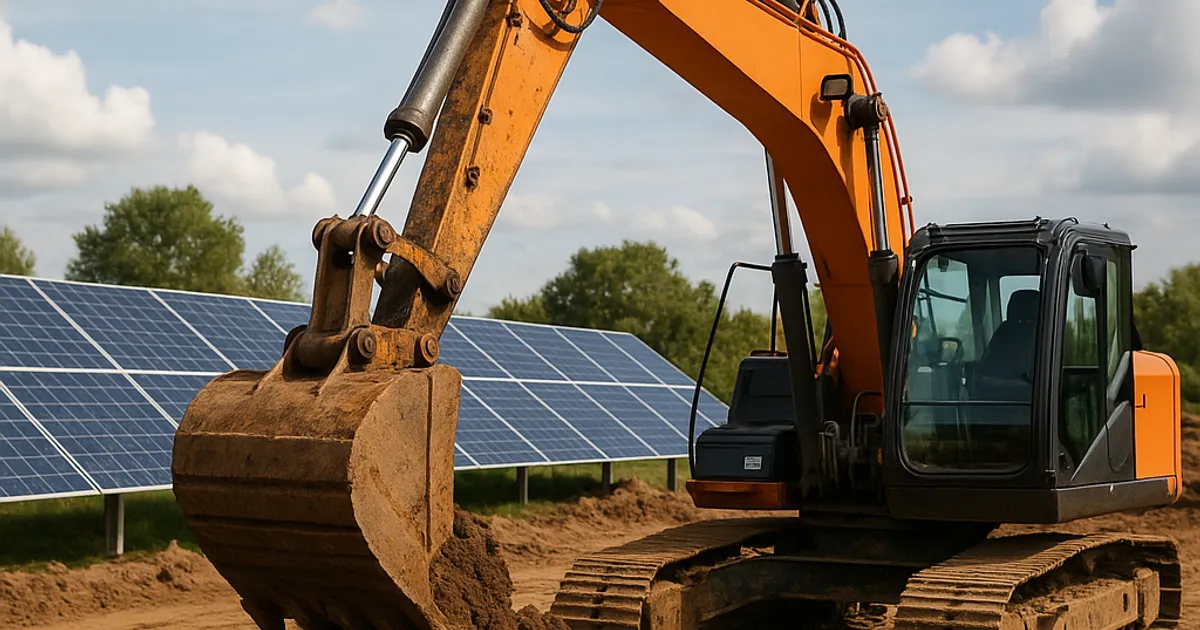
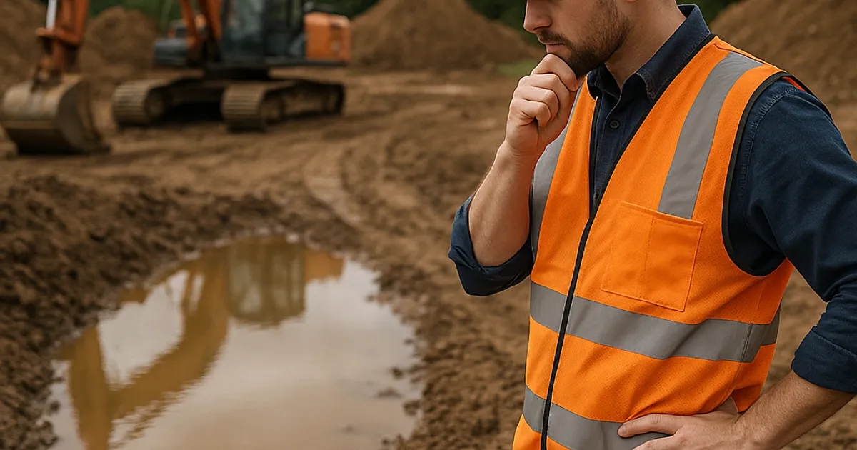
Drainage problems on a construction site do not announce themselves with warning signs posted at the gate. They hide in soil texture, subtle topography, seasonal water patterns, and soil survey data that too many contractors skip during project planning. By the time a grading crew discovers standing water, rutted access roads, or saturated subgrade, the schedule has already slipped and the budget is bleeding.
According to the Federal Highway Administration, poor site drainage is one of the leading causes of premature pavement failure and earthwork rework on construction projects across the country. For earthwork contractors working in high-precipitation regions like the Pacific Northwest or the high-altitude terrain around dirt exchange in Denver, the cost of ignoring drainage assessments before grading can reach tens of thousands of dollars in remediation, equipment downtime, and schedule penalties.
This guide is built for earthwork contractors, site supervisors, project engineers, and grading subcontractors who want a systematic, field-tested approach to identifying drainage problems before the first cut is made. Every section breaks down a specific category of risk, the signs to look for, and the corrective actions that protect your project.
Why Pre-Grade Drainage Assessment Matters More Than Ever
The earthwork industry has evolved significantly over the past decade. Machine control technology from companies like Trimble Construction allows grading crews to work with millimeter-level precision. But no amount of GPS-guided blade control can compensate for a drainage plan built on incomplete site information.
Pre-grade drainage assessment is the process of systematically evaluating a site's existing hydrologic conditions, soil characteristics, and topographic features before any grading work begins. It is not simply walking the site and eyeballing low spots. It involves reading soil surveys, reviewing historical aerial imagery, evaluating existing vegetation patterns, and understanding how water moves through and across the site under various precipitation scenarios.
The stakes are significant. A 2026 survey by the Associated General Contractors of America found that schedule delays caused by unforeseen site conditions, including unexpected drainage and soil saturation issues, remain among the top five cost overruns on earthwork projects. When a site is graded without accounting for poor drainage, contractors face compaction failures, erosion events that trigger EPA stormwater violations, and subgrade instability that forces costly re-grading or undercutting.
For projects in urban infill markets like dirt exchange in San Francisco or dirt exchange in Boston, drainage problems carry additional regulatory weight. Stormwater management regulations have tightened considerably, and the EPA's NPDES Construction General Permit requires active stormwater pollution prevention planning on sites disturbing one or more acres. Catching drainage problems before grading keeps your SWPPP accurate and defensible.
The good news is that most drainage problems leave clear evidence long before your equipment arrives. The challenge is knowing where to look and what the evidence means.
Reading the Landscape: Topographic Red Flags
The first layer of drainage assessment happens on paper or on screen before you ever set foot on the site. Topographic data is your earliest warning system.
Closed Depressions and Flat Gradients
Closed topographic depressions, areas where contour lines form closed loops with no outlet, are reliable indicators of ponding risk. Water that enters a closed depression has nowhere to go except into the soil or through evaporation. On sites with low-permeability soils, closed depressions pond rapidly during rain events and can remain saturated for days or weeks after precipitation stops.
Flat gradients are equally problematic. The general industry standard for positive drainage away from structures is a minimum slope of 2 percent, or roughly 2 feet of fall per 100 feet of horizontal distance. Sites with existing grades below 1 percent are at high risk for sheet flow stagnation, where water moves so slowly that it effectively pools across large areas rather than draining to an outlet.
Upslope Contributing Areas
One of the most commonly overlooked topographic factors is the size and character of the upslope contributing area. Your site does not just drain internally. It also receives runoff from adjacent higher ground. Calculate the total watershed area that drains toward your site using USGS topographic maps or LiDAR data. A site with a large upslope contributing area needs inlet infrastructure and grading plans that account for that external water load.
Many contractors discover mid-project that they underestimated offsite flow contributions, which forces expensive inlet redesigns or emergency swale construction during active earthwork. Review 100-year storm event data from your local county hydrology manual and confirm that your proposed grades and drainage structures can handle peak flow from both the site and its contributing watershed.
Natural Drainage Channels and Wetland Indicators
Existing drainage channels, even seasonal ones that appear dry during site visits, represent established hydrologic pathways that cannot be casually filled or relocated without regulatory consequence. The Army Corps of Engineers regulates the filling of wetlands and waters of the United States under Section 404 of the Clean Water Act. Filling an ephemeral stream or seasonal wetland without a permit can halt a project entirely and trigger significant fines.
Look for braided or meandering low areas in aerial imagery, even if they appear dry on the ground. Vegetation patterns often reveal these features more clearly from above than at grade level.
Soil Survey Analysis: Your Underground Drainage Map
Soil type is the single most important factor governing how water moves through a site, and yet soil survey review is one of the most frequently skipped steps in pre-grade planning on smaller projects.
The USDA Natural Resources Conservation Service maintains the Web Soil Survey, a free, publicly accessible database that provides detailed soil mapping for virtually every county in the United States. Within minutes, you can pull up a soil report for any parcel that includes hydrologic soil groups, drainage class ratings, seasonal high water table depth, and permeability values.
Understanding Hydrologic Soil Groups
The NRCS classifies soils into four hydrologic soil groups based on their runoff potential.
| Hydrologic Group | Runoff Potential | Typical Soil Types | Drainage Implication |
|---|---|---|---|
| Group A | Low | Sandy, gravelly soils | Excellent drainage, low ponding risk |
| Group B | Moderate | Sandy loams, loams | Good drainage with minor risk |
| Group C | High | Silt loams, sandy clays | Slow infiltration, elevated ponding risk |
| Group D | Very High | Clays, clay loams | Very slow infiltration, high ponding risk |
Sites dominated by Group C and Group D soils require drainage designs that explicitly account for low permeability. French drains, interceptor swales, and underdrains are often necessary features rather than optional upgrades. Grading plans that assume average infiltration rates on a Group D clay site will fail predictably under wet conditions.
Seasonal High Water Table Depth
The NRCS soil survey also reports the estimated depth to seasonal high water table (SHWT). This value represents the highest level that saturated soil conditions are expected to reach during a typical year. Sites with a SHWT within 18 to 24 inches of the surface carry significant compaction and subgrade stability risk during wet seasons.
If your grading work will occur during or after the wet season in a region with a shallow water table, plan for the possibility that your subgrade may be saturated even if surface conditions look acceptable. Proof rolling during earthwork, using a loaded dump truck or roller to detect soft spots, is a standard quality control method but is only useful if drainage conditions are understood in advance.
Clay Content and Shrink-Swell Potential
High-plasticity clays present a unique drainage challenge. These soils expand when wetted and contract when dry, creating surface cracking patterns that can actually appear to indicate good drainage during dry periods but become highly impermeable when rewetted. Sites with expansive clays, common in areas like Texas, Colorado, and parts of the Southeast, require careful attention to grading design to prevent differential settlement and surface ponding.
ASTM D2487, the Standard Practice for Classification of Soils for Engineering Purposes, provides the framework for classifying soils by plasticity and grain size. Knowing where your site falls on the Unified Soil Classification System before grading begins allows you to make informed decisions about cut and fill placement, moisture conditioning, and compaction specifications.
Field Reconnaissance: What Your Eyes Tell You On-Site
Office research establishes the framework. Field reconnaissance confirms it and fills in the details that maps and surveys cannot capture. A structured site walk performed with drainage in mind is one of the highest-value hours you can invest before mobilizing equipment.
Vegetation as a Drainage Indicator
Plants are extraordinarily reliable indicators of soil moisture conditions. Certain plant species thrive only in consistently wet or periodically saturated conditions, making them natural flags for areas of poor drainage.
Common wetland indicator plants that signal persistent soil saturation include cattails (Typha spp.), rushes (Juncus spp.), sedges (Carex spp.), willows (Salix spp.), and reed canary grass (Phalaris arundinacea). The presence of any of these species in your site area warrants a soil probe to check for hydric soil indicators before proceeding.
Conversely, upland plant communities dominated by drought-tolerant grasses and shrubs generally indicate well-drained soils with deeper water tables. This vegetative contrast across a single site can reveal the precise boundary between drainage zones and help you plan grading sequences that keep equipment on firm ground.
Staining, Mottling, and Soil Color Patterns
Once you begin pulling soil samples or examining road cuts and exposed banks, soil color becomes a critical diagnostic tool. Hydric soils, those that form under saturated conditions, typically display characteristic color patterns called mottling. Mottled soils show irregular blotches of gray, blue-gray, or greenish-gray (chroma 2 or less on the Munsell Soil Color Chart) mixed with orange or red oxidized zones.
These mottles form at the depth where the soil transitions between aerobic and anaerobic conditions seasonally, making them a direct indicator of the seasonal high water table depth in the absence of a formal soil survey. Finding distinct mottling within 18 inches of the surface during a field probe is a reliable sign that the site experiences periodic saturation and requires drainage accommodation in the grading plan.
Surface Evidence of Historical Ponding
Even during dry weather, sites often bear evidence of their wet-season behavior. Look for these surface indicators during your field walk.
Algae or moss on soil surfaces. Biological crusts dominated by algae or moss form where standing water is a regular occurrence. Their presence on bare soil indicates extended inundation periods.
Sediment rings or water marks on vegetation. Horizontal staining or sediment deposits on tree trunks, fence posts, and other fixed objects reveal the historical high-water mark on the site.
Compaction and pugging patterns in existing turf. Areas where livestock or foot traffic has created deeply rutted or pugged soil surfaces indicate zones where the soil stays saturated long enough to lose structural integrity under load.
Oxidized rhizospheres. When examining soil profiles, look for reddish-orange halos around old root channels. This oxidized rhizosphere indicates roots were releasing oxygen into otherwise anaerobic, saturated soil, a classic hydric soil indicator.
Reviewing Historical Aerial Imagery for Drainage Clues
Historical aerial photography is one of the most underutilized tools in pre-grade drainage assessment. Decades of imagery are available through Google Earth Pro, the USGS Earth Explorer platform, and county GIS systems, and this imagery often reveals drainage patterns that current site conditions obscure.
Look for the following when reviewing historical aerials for a site.
Seasonal variation in vegetation greenness. If certain portions of the site remain green late into dry seasons while surrounding vegetation browns, those areas are likely receiving subsurface moisture that supports vegetation through summer drought. This is a reliable indicator of a higher water table or subsurface flow concentration.
Standing water in winter or spring imagery. Imagery captured during or shortly after wet periods will show ponding locations directly. Many county aerial programs capture imagery specifically during wet seasons, making these archives particularly valuable.
Historical land use patterns. Former agricultural drainage tile systems, filled ponds, abandoned irrigation infrastructure, and old landfill areas all affect drainage behavior in ways that are not visible on the surface. Historical imagery and old topographic maps can reveal these features before they become expensive surprises during earthwork.
Erosion patterns and rill formation. Visible rilling or gullying in imagery indicates concentrated surface flow, which points to both drainage pathways and potential erosion hotspots that need to be addressed in the grading and erosion control design.
Assessing Existing Drainage Infrastructure
Very few greenfield sites are completely undeveloped. Most have some combination of existing drainage features, including ditches, culverts, inlet structures, or subsurface tile systems. Evaluating the condition and capacity of this existing infrastructure before grading is essential to understanding what the site can handle and what needs upgrading.
Culvert Capacity and Condition Evaluation
Existing culverts are frequently undersized for modern land use and runoff rates. A culvert installed for an agricultural field in the 1970s almost certainly lacks the capacity required to serve a commercial development site with high impervious coverage. Evaluate every culvert on or adjacent to your site for inlet and outlet condition, structural integrity, diameter, material, and approximate hydraulic capacity.
A culvert that is partially collapsed, filled with sediment, or dramatically undersized becomes a hydraulic restriction that will back up water during storm events, potentially flooding active grading areas and creating safety hazards. Replacing or upsizing these structures before grading begins, rather than after, is almost always the more cost-effective approach.
Roadside Ditch Connectivity
Many sites drain to roadside ditches maintained by the county or municipal transportation department. Verify that these receiving ditches are open, functional, and capable of accepting the increased runoff your project will generate. Contact the relevant agency to understand whether a drainage permit or connection approval is required before you outlet stormwater to their system.
Some jurisdictions require formal hydraulic studies demonstrating no increase in peak runoff before allowing connections to public drainage infrastructure. Discovering this requirement after grading has already altered site grades can force expensive detention or retention basin construction under time pressure.
Seasonal Timing: When You Grade Matters as Much as How You Grade
The best-designed grading plan can be undermined by executing it at the wrong time of year. Understanding seasonal drainage cycles in your region and scheduling grading work accordingly is a practical skill that experienced earthwork contractors develop over years of site observation.
In the Pacific Northwest, including markets served by dirt exchange in Seattle, the wet season effectively runs from October through May. Initiating major cut operations during this period on clay-dominant sites typically results in equipment ruts, subgrade disturbance, and compaction failures that require expensive remediation before structural fills can proceed. Many experienced crews in this region schedule rough grading during the narrow summer window specifically to avoid wet-season soil instability.
In the Mountain West, including Colorado and surrounding states, spring snowmelt creates a secondary wet season that can last well into June at higher elevations. Sites that appeared workable in early spring surveys may become saturated weeks later as snowpack melts from higher terrain and migrates through the soil profile. Grading near dirt exchange in Boulder requires particular attention to snowmelt hydrology and the high-clay soils common in the Front Range region.
The general principle is to align your most sensitive grading operations, finish grading, subgrade preparation, and structural fill placement, with the driest, most stable period for your region's soil conditions. This is not always possible given project schedules, but even modest adjustments to sequencing, such as completing rough cut work during dry periods and delaying finish grading until the wet season has passed, can significantly reduce drainage-related problems.
Find or Post Dirt, Rock & Aggregate
Join thousands of contractors using DirtMatch to buy, sell, and exchange earthwork materials.
Try DirtMatch FreeEPA Stormwater Compliance and Drainage Assessment Overlap
Pre-grade drainage assessment is not just a construction quality issue. It is a regulatory compliance issue on any site disturbing one or more acres of land. The EPA's National Pollutant Discharge Elimination System Construction General Permit (CGP) requires operators to develop and implement a Stormwater Pollution Prevention Plan before construction begins.
A credible SWPPP depends on accurate knowledge of existing site drainage patterns, soil erodibility, and slope characteristics. All of these elements are products of the same pre-grade assessment process described throughout this article. Contractors who conduct thorough drainage assessments before grading begin with the information they need to write accurate SWPPPs, while those who skip this step often find their erosion control measures inadequate when the first significant rain event hits an active grading site.
The consequences of NPDES violations on construction sites are significant. Fines can reach up to $25,000 per day per violation, and repeated or egregious violations can result in stop-work orders that freeze the entire project. Beyond fines, erosion events and illegal discharges damage relationships with local regulators, municipalities, and neighboring property owners. Learn more about federal stormwater requirements for construction sites through the EPA Stormwater Construction program page.
Drainage Assessment Checklist: A Field-Ready Summary
Use this structured checklist during your pre-grade site assessment to ensure you have covered each critical drainage evaluation category.
| Assessment Category | Key Actions | Red Flag Indicators |
|---|---|---|
| Topographic Review | Review LiDAR/topo maps for closed depressions | Closed contours with no outlet, grades below 1% |
| Soil Survey | Pull NRCS Web Soil Survey report | Group C or D soils, SHWT within 24 inches |
| Vegetation Survey | Walk site for hydric plant species | Cattails, sedges, rushes, reed canary grass |
| Soil Profile | Probe to 36 inches and check color | Mottling, blue-gray gleying, organic matter |
| Historical Imagery | Review 10+ years of aerial imagery | Standing water, persistent green zones |
| Existing Infrastructure | Inspect all culverts, ditches, inlets | Blocked, collapsed, or undersized structures |
| Upslope Contributing Area | Calculate offsite watershed contributions | Large upslope area, no inlet capacity planned |
| Regulatory Review | Check NPDES, Section 404, local permits | Any wetland indicators, streams, water of US |
| Seasonal Timing | Confirm project schedule vs. wet season | Grading scheduled during peak wet period |
How DirtMatch Helps Contractors Plan Around Drainage Challenges
One of the most significant logistical challenges that drainage problems create is the need to import or export material on short notice. When a pre-grade assessment reveals unsuitable in-situ soils, high water tables, or the need for additional structural fill or clean aggregate for drainage layers, contractors need reliable sources and fast connections.
For earthwork contractors managing tight project schedules, DirtMatch provides a direct connection to verified sources of fill dirt, clean rock, aggregate, and drainage material across their region. When your drainage assessment reveals that the on-site material is too plastic for structural fill and you need to import gravel or crushed rock for a drainage blanket, having access to a network of nearby suppliers and excess material holders can reduce hauling costs and mobilization time significantly.
Whether you are working on a commercial pad, residential subdivision, or public infrastructure project, the ability to quickly source or offload material is a major operational advantage. Get started with DirtMatch to explore how the platform connects earthwork contractors with the right materials at the right time, particularly during those high-pressure moments when a drainage problem is discovered mid-project and the schedule cannot absorb a week-long search for aggregate.
Corrective Actions: What to Do When You Find a Drainage Problem
Identifying a drainage problem before grading is only valuable if you act on the information. Each category of drainage issue has a set of corrective design and construction responses that should be incorporated into the project plan before work begins.
Underdrains and Drainage Blankets
For sites with high water tables or low-permeability subgrades, underdrains are often the most cost-effective solution. A typical underdrain consists of perforated pipe wrapped in geotextile fabric, bedded in clean gravel, and installed below finished subgrade elevation to intercept and redirect groundwater before it saturates the structural fill. Drainage blanket layers of clean crushed stone placed beneath structural fill sections provide a capillary break and allow water to migrate laterally to edge drains.
Interceptor Swales and Perimeter Ditches
When the primary drainage problem is offsite surface flow entering the site, interceptor swales installed at the uphill perimeter of the grading limits can redirect this water around the active work area before it can saturate the subgrade. Properly designed and stabilized interceptor swales are also a required erosion control BMP on most permitted construction sites, making them a dual-purpose solution.
Fill Import and Subgrade Replacement
When in-situ soils are too wet, too plastic, or too organic to serve as structural subgrade, undercut and replacement with approved fill is often the most reliable long-term solution. This is where material sourcing becomes critical. The cost of importing clean, well-graded fill or compactable aggregate can be significant, but it is almost always less expensive than the alternative of reworking a failed subgrade after paving or structure placement.
Platforms like DirtMatch connect contractors with verified sources of structural fill, gravel, and aggregate in their region, helping reduce the cost and time required to source replacement material when a drainage problem demands it.
Grade Revision and Outlet Design
Sometimes the simplest corrective action is redesigning grades to steepen the drainage gradient, eliminate closed depressions, and establish positive flow to a defined outlet. This requires coordination between the earthwork contractor and the project civil engineer but can often be accomplished with minimal redesign cost if caught before grading begins rather than after.
Communicating Drainage Risk to Project Owners and Engineers
Even the most thorough pre-grade drainage assessment only adds value if the findings are communicated clearly to the project team. Earthwork contractors who identify drainage risks and document them in writing protect themselves from later cost disputes and demonstrate the kind of professional competence that builds long-term client relationships.
When your site assessment reveals significant drainage concerns, prepare a written summary that includes specific observations, locations, supporting data from soil surveys or borings, photographic documentation, and recommended corrective actions with approximate cost implications. This documentation creates a record that the risk was identified and communicated before grading began, which is important if the corrective work later becomes a change order.
Project owners who work with contractors through platforms like DirtMatch benefit from the platform's network of experienced earthwork professionals who bring this kind of site assessment expertise to projects from the start. Connecting with contractors who understand drainage risk assessment before grading begins is one of the clearest ways to protect a project's budget and schedule from preventable complications.
Building a Drainage-First Culture on Your Crew
The most effective long-term strategy for managing jobsite drainage problems is developing a crew culture where drainage awareness is embedded in every pre-construction conversation, every site walk, and every equipment staging decision. This means training field supervisors to recognize hydric soil indicators, empowering equipment operators to flag soft or saturated conditions before they create ruts, and establishing clear protocols for documenting and escalating drainage concerns before they become crises.
Investing in crew education on soil classification, drainage assessment, and erosion control not only reduces project risk but also builds the kind of reputation that generates repeat business and referrals. Owners and general contractors remember the earthwork subs who flagged a drainage problem before it cost everyone money and the ones who graded through obvious warning signs until the site turned to mud.
The industry associations and training resources available through the AGC of America provide formal education pathways for site supervisors and project managers who want to build structured drainage assessment skills into their professional practice.
Conclusion: Assessment Before Grading Is Your Best Investment
Jobsite drainage problems are among the most predictable and preventable sources of cost overruns in earthwork contracting. The vast majority of drainage failures that occur during and after grading can be traced back to information that was available before a single blade moved dirt, but was never collected, analyzed, or acted upon.
The framework laid out in this article, topographic review, soil survey analysis, field reconnaissance, historical imagery review, and existing infrastructure evaluation, requires a modest investment of time before mobilization but delivers returns in reduced rework, fewer schedule delays, tighter regulatory compliance, and stronger client relationships.
For earthwork contractors ready to work smarter and connect with the materials and project opportunities that match their capabilities, DirtMatch is built for exactly this industry. Explore the platform to find fill material sources, connect with projects in your region, and build the kind of efficient, informed operation that turns drainage challenges into competitive advantages.